Select | Format | USD( ) |
---|---|---|
Print Book | 96.00 76.80 20%Off | |
Individual E Book | Buy Now | |
Institutional E Book | Price available on request |
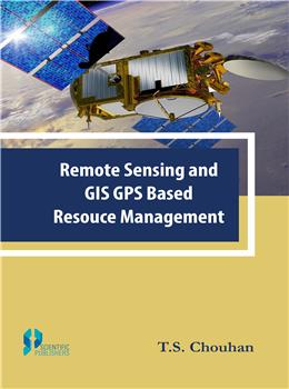
Remote sensing and Geographical Information System (GIS) offers an abundant opportunity to monitor and manage natural resources at multi-temporal, multi-spectral and multi-spatial resolution. This system is based on new tools and sources of information provided by modern technologies. These include Remote Sensing (RS), Geographic Information System (GIS) and Global Positioning System (GPS) are such technologies that are much more reliable, precise and efficient as well than any other resource assessment technology. These technologies give a visual impression of the landscape that helps to make quick decision in resource management. Satellite remote sensing, in conjunction with geographic information systems (GIS), has been widely applied and been recognized as a powerful and effective tool in detecting land use and land cover change. It provides cost-effective multi-spectral and multi-temporal data, and turns them into information valuable for understanding and monitoring land development patterns.
1 Introduction
2. Geographical Information System
3. Global Positioning System
4. Blazing Technologies
5 Formulation of GIS for Resource Assessment
6. Physio- Climo and Biotic Resources
7. Land, Water and Irrigation Resource
8 Mineral, Power and Industrial Development
9 Human and Livestock Resources
10 Transportation and Communication
11.Case Study 11.1.Case Studies
Case Study 11.2. Impact Assessment Study of Rainwater Harvesting/ Recharging Structures in Bikaner District
Case Study 11.3. Assessment of Potential Recharge Areas in Four Districts of Rajasthan
Case Study 11.4. Mapping of High Risk Behaviour Population Groups in Rajasthan
Case Study 11.5. GIS based Mapping of Mines, Mineworkers and high Risk Behaviour Groups in Rajasthan
Case Study 11.6. Benefit Assessment of Rain Water Harvesting Structures In Three Blocks of Udaipur District
Case Study 11.7. GIS Based Mapping of Water Supply System,Drainage and Solid Waste Management System of Sunel Town of Jhalawar District
12. Sustainable Development Plan
Bibliography
SCIENTIFIC PUBLISHERS
"Granthlok"
5-A,New Pali Road,
Bhagat Ki Kothi (Nr. Police Station)
P. O. Box 91, Jodhpur - 342001 (Rajasthan), INDIA
Mob. :+91-9929272222 +91-9799991782
Tel. :+91-2912433323
Email. info@scientificpub.com
Web. www.scientificpubonline.com
DELHI BRANCH
"Granthlok"
4806/24, Ansari Road,
Bharat Ram Road,
Darya Ganj
New Delhi 110002
INDIA
Mob. : +91-95211 31111
Tel. +91-11-47590696
Email. scientificpubdelhi@gmail.com
Make sure you dont miss interesting happenings by joining our newsletter program
Government e Marketplace (GeM) is a 100 percent Government owned & National Public Procurement Portal.GeM is dedicated e market for different goods.
© 2024 SCIENTIFIC PUBLISHERS | All rights reserved.